 |
||||||||||||||||||||||||
1906 redistribution - 1906 & 1910 electionsUnder the terms of the Commonwealth Electoral Act 1902, commissioners were appointed to create federal divisions for South Australia and Tasmania and also to redistribute the divisions in the other four States. As it eventuated, only the reports for South Australia and Tasmania were accepted by the Parliament in 1903 and hence it was not until 13 July 1906 that a redistribution was proclaimed affecting the five Western Australian divisions; and the resultant boundaries were subsequently used in the 1906 and 1910 elections. The redrawn Fremantle electorate (see Map 2) extended eastwards south of the river beyond Belmont through to Midland and Swan View, then southwards to Forrestfield and south westerly to Kardinya and Hamilton Hill. The division now included only a narrow ocean strip down to Coogee but no longer encompassed Spearwood and the country regions to the south and east. North of the Swan River, the western suburbs of Claremont, Cottesloe and Nedlands remained within the district and in the north-east, the division now encompassed Beechboro and Mirrabooka. The official subdivisions designated for the 1910 election included Guildford, Canning and Claremont, along with Fremantle, North Fremantle, East Fremantle and South Fremantle. |
||||||||||||||||||||||||
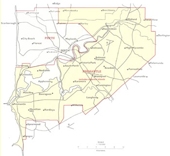
Map 2: The federal electorate of Fremantle from 1906-1912. JCPML. Records of the John Curtin Prime Ministerial Library. Fremantle electorate map, 1906-1912. JCPML00968/1/2. |
||||||||||||||||||||||||
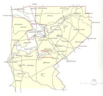
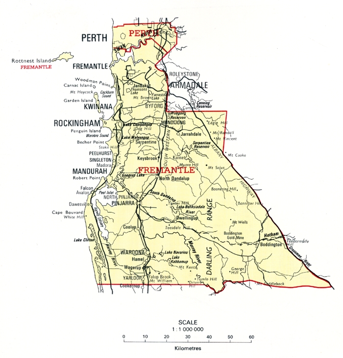
1913 redistribution - 1913, 1914, 1917 & 1919 electionsThe next redistribution was proclaimed on 1 February 1913 and the resultant boundaries were used in the 1913, 1914, 1917 and 1919 elections. In this redistribution the seat of Coolgardie was abolished and replaced by the new seat of Dampier. Fremantle was enlarged geographically (see Maps 3A and 3B), gaining additional suburbs north of the river including Yokine, Morley and Maylands in the north-east and City Beach and Floreat along the coast. (During these years the neighbouring seat of Perth included Perth itself and surrounding areas including Subiaco as well as extending along the coast north of City Beach around Scarborough.) The Fremantle electorate also regained territory east of Coogee and Spearwood and extended into country areas to the south beyond Mandurah and regions inland. Designated subdivisions in Fremantle included (a) Fremantle, and North, East and South Fremantle (b) Claremont and West Subiaco (c) Maylands (d) Guildford and (e) Murray. |
||||||||||||||||||||||||
|
Map 3A |
||||||||||||||||||||||||
|
Map 3B |
Maps 3A & 3B: The federal electorate of Fremantle from 1913-1921. JCPML. Records of the John Curtin Prime Ministerial Library. Fremantle electorate map, 1913-1921. JCPML00968/1/3. |
|||||||||||||||||||||||
1922 redistribution
|
||||||||||||||||||||||||
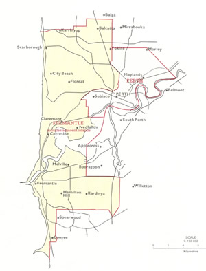
Map 4: The federal electorate of Fremantle from 1922-1936. JCPML. Records of the John Curtin Prime Ministerial Library. Fremantle electorate map, 1922-1936. JCPML00968/1/4 |
||||||||||||||||||||||||
2. The creation of electorates of Forrest, Reid and Barton meant this was the first time the names of former politicians had been used for federal electoral divisions. Of the federation pioneers Deakin and Kingston were not so honoured until later (1936 and 1948 respectively) as there were no new seats in Victoria or South Australia at the time. Early prime ministers added to the list before 1945 also included Watson in 1934, while there had been a division of Cook since 1906 named after the famous explorer. Back |
||||||||||||||||||||||||