 |
||||||||||||||||||||||||
1937 redistribution
|
||||||||||||||||||||||||
Map 5: The federal electorate of Fremantle from 1937-1948. JCPML. Records of the John Curtin Prime Ministerial Library. Fremantle electorate map, 1937-1948. JCPML00968/1/5. |
||||||||||||||||||||||||
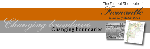
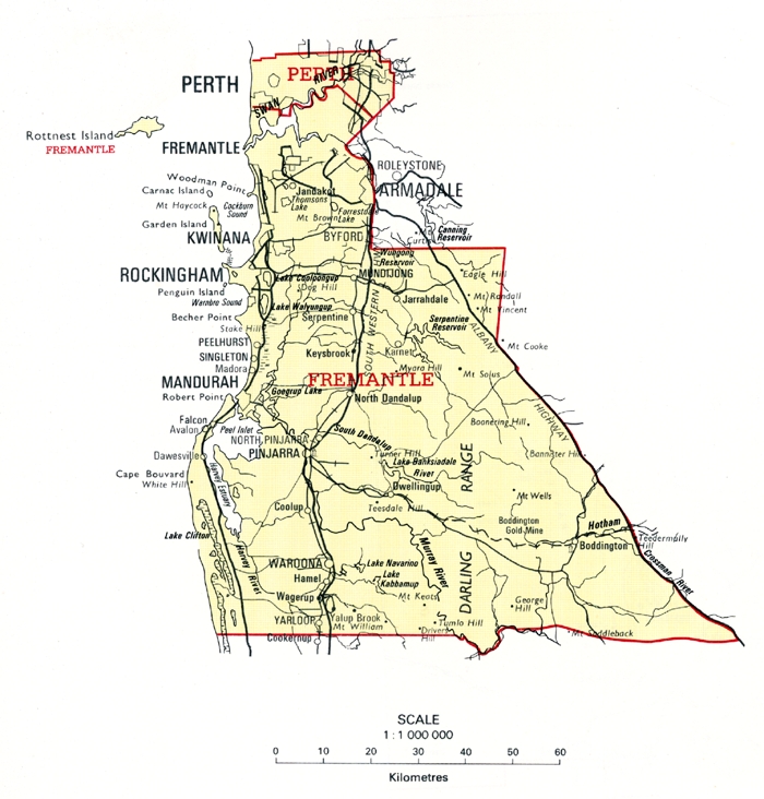
1949 redistribution - 1949, 1951 & 1954 electionsOn 11 May 1949 a redistribution was gazetted providing for the new expanded 121 member House of Representatives. Western Australia now had 8 federal electorates following the addition of the new seats of Canning, Moore and Curtin3 to the existing 5 seats. (John Curtin was the second former parliamentarian to be honoured in this way in Western Australia.) 47 members now came from New South Wales, 33 from Victoria, 18 from Queensland and 10 from South Australia while Tasmania retained its original 5 members. These boundaries were used for the 1949, 1951 and 1954 elections. With the additional number of seats Fremantle had a much reduced enrolment of 43,467: the largest division was Swan with 46,789 and the smallest Kalgoorlie with 31,619. Fremantle's geographical spread (see Map 6) was reduced with the excision of Nedlands and Leederville, though the electorate still retain City Beach and Floreat as well as South Perth and Victoria Park. The subdivisions now were Claremont, Wembley Park and the Fremantle group (Fremantle, East Fremantle, North Fremantle and South Fremantle). |
||||||||||||||||||||||||
Map 6: The federal electorate of Fremantle from 1949-1954. JCPML. Records of the John Curtin Prime Ministerial Library. Fremantle electorate map, 1949-1954. JCPML00968/1/6 |
||||||||||||||||||||||||
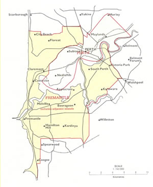
1955 redistribution - 1955, 1958, 1961, 1963 & 1966 electionsThe redistribution proclaimed on 10 August 1955 was used for elections in 1955, 1958, 1961, 1963 and 1966. Western Australia secured an additional ninth seat in Stirling incorporating suburban areas north of City Beach and Maylands and extending east to Midland. The initial enrolment in Fremantle was 41, 247, nearly 8,000 fewer than in 1954, though the division was still within a few hundred of being the most populated electorate in the State. The area in the electorate (see Map 7) to the north of the river was further truncated, excluding Claremont, Wembley, City Beach and Floreat (all now included in Curtin) but still incorporating Cottesloe, Mosman Park and North Fremantle. South of the river the eastern boundary was the Canning River and a line running south from there. The subdivisions now were Melville (consisting by 1966 of approximately 46% of the electors), Fremantle, South Fremantle and Claremont. |
||||||||||||||||||||||||
Map 7: The federal electorate of Fremantle from 1955-1967. JCPML. Records of the John Curtin Prime Ministerial Library. Fremantle electorate map, 1955-1967. JCPML00968/1/7. |
||||||||||||||||||||||||
3. The new seat of Curtin was located in the metropolitan area incorporating most of the western suburbs and areas further north and close to the city. Moore and Canning were rural electorates, the former taking in much of the wheatbelt extending south from near Geraldton to east of Perth including Kellerberrin, Merredin and Southern Cross while Canning took in coastal and wheat belt areas between Perth and Bunbury with its wheat belt component extending as fare south as Wagin and east of Lake Grace and Hyden. Forrest encompassed the remainder of the south west and Great Southern while Kalgoorlie extended across all the rest of non metropolitan WA. Back |
||||||||||||||||||||||||
|
|
||||||||||||||||||||||||